Home Screen
AirMagnet Survey PRO allows you to predictively model Wi-Fi network changes or design a new network for optimal coverage, connectivity, and performance. It also allows you to simulate changes to an existing network, compare a design versus a survey side-by-side, automatically validate requirements, or generate custom reports.
Models
| Model Number/Name | Description |
| AM/A4018G | AirMagnet Survey PRO (includes Planner) |
| AM/A4012G | AirMagnet Planner |
| AM/B4010G | AirMagnet Survey Express |
| AM/A4016G | AirMagnet Survey Express to Survey PRO (upgrade model) |
| AM/D1095 | AirMagnet Multi-Adapter Kit for Survey (only available for US and Canada) |
| AIRCHECK-G3-PRO | Includes: AIRCHECK-G3-PRO mainframe with 1 year of AllyCare support (AIRCHECK-G3-PRO-1YS), shoulder sling bag, AC charger, and Quick Start Guide. |
| TEST-ACC | Test Accessory Pocket iPerf Server, for use with AirCheck G3 and AirMagnet Survey (can be used independently) |
Documents
Capabilities
-

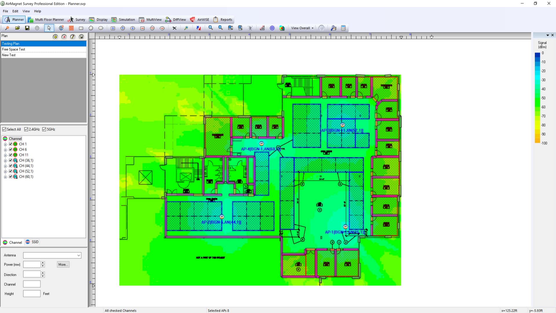
Wi-Fi Modeling with AP Placement
-

-

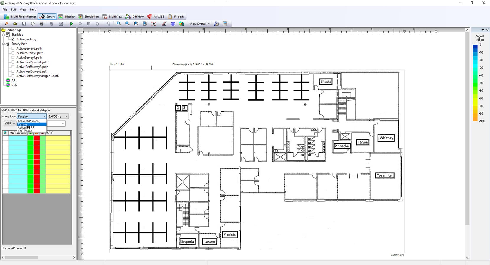
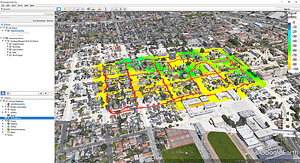
Real-World Survey Data & GPS Support
-
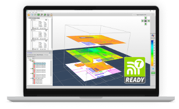
Get the most out of your Wi-Fi 7 network with AirMagnet Survey PRO. This wireless site survey tool helps you build detailed models of any wireless environment – even before the network is deployed or the building is constructed. Using AirMapper™ Site Survey on the AirCheck® G3, EtherScope® nXG, CyberScope® or CyberScope® Air, you can optimize your network for maximum performance.
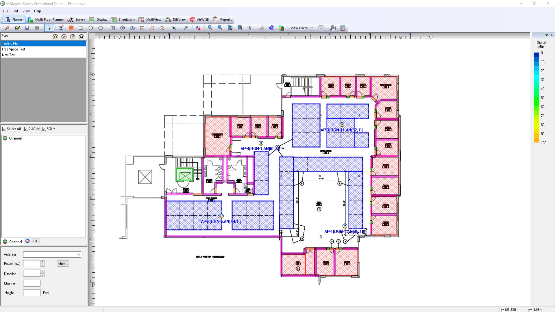
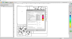
Our automated AP placement feature streamlines network design:
- Load location maps and use the built-in library of walls, doors and windows to precisely match building characteristics
- Get automated suggestions for optimal access point placement
- Set independent configurations for all frequency bands including channel, IP address, transmit power, antenna type, orientation, and height
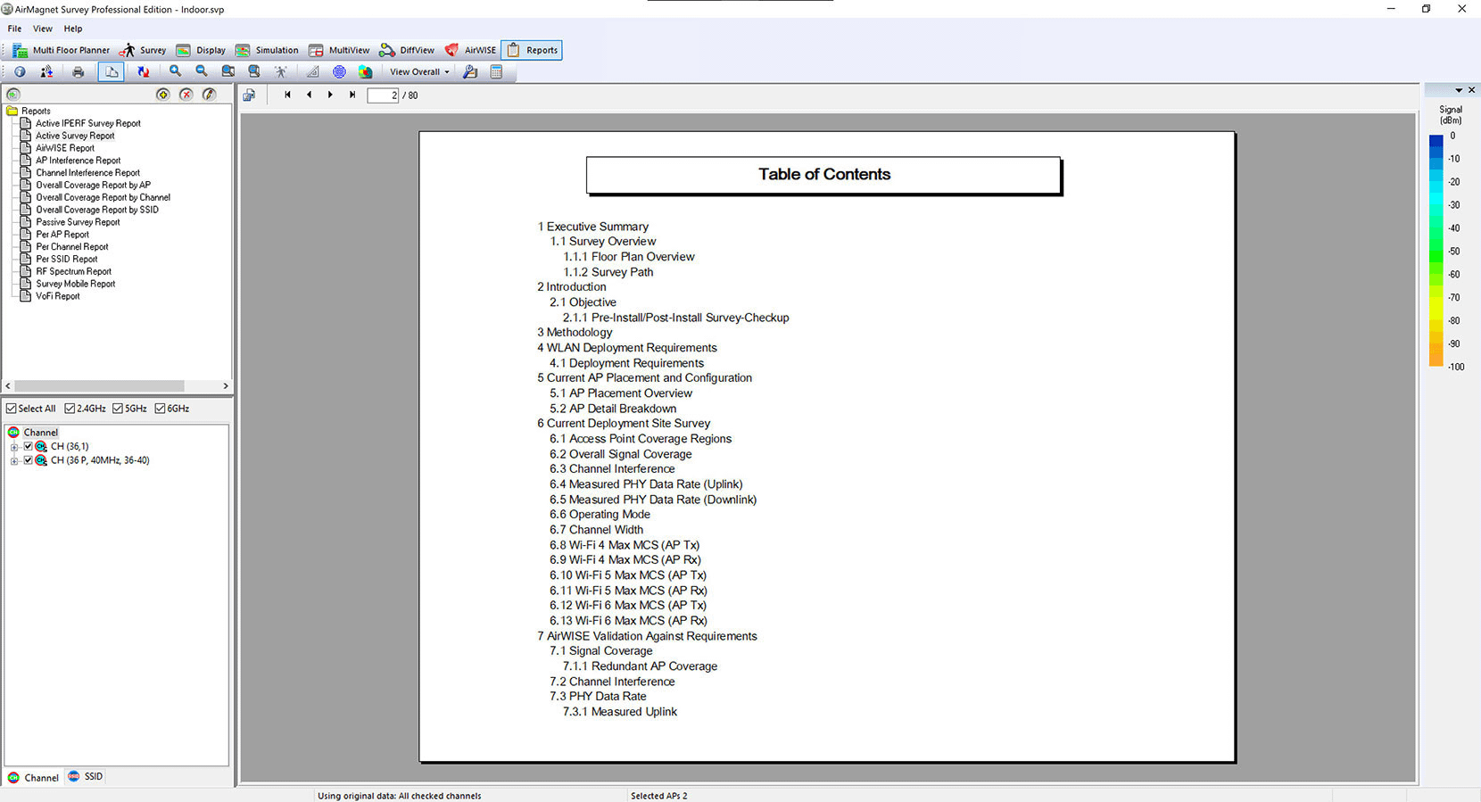
- Generate professional reports with installation specifications and RF coverage information
- Experiment with “what-if” scenarios by adjusting AP settings or testing additional AP locations
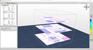
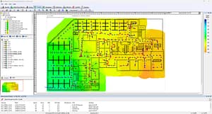
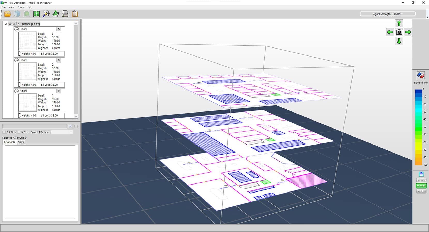
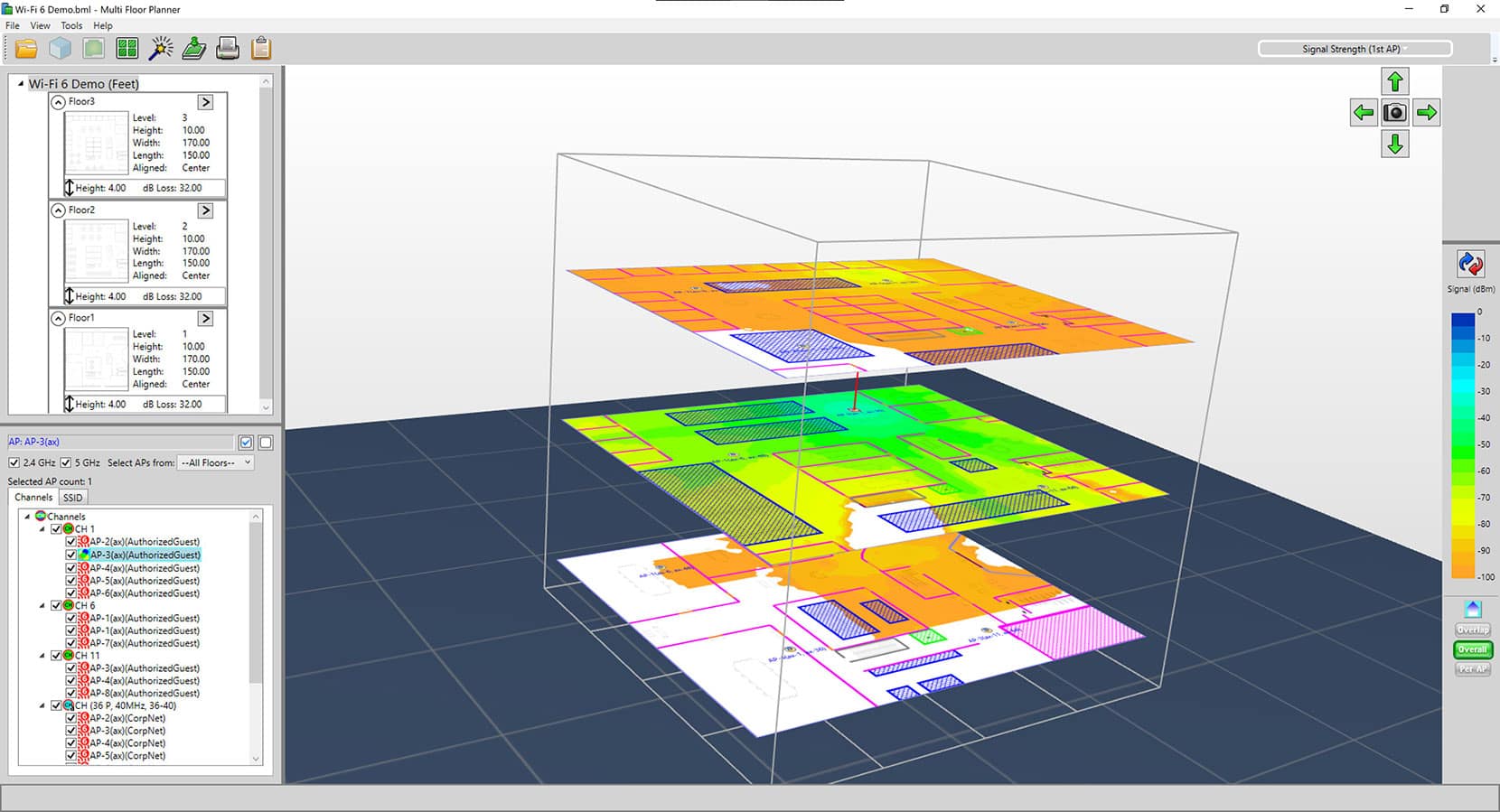
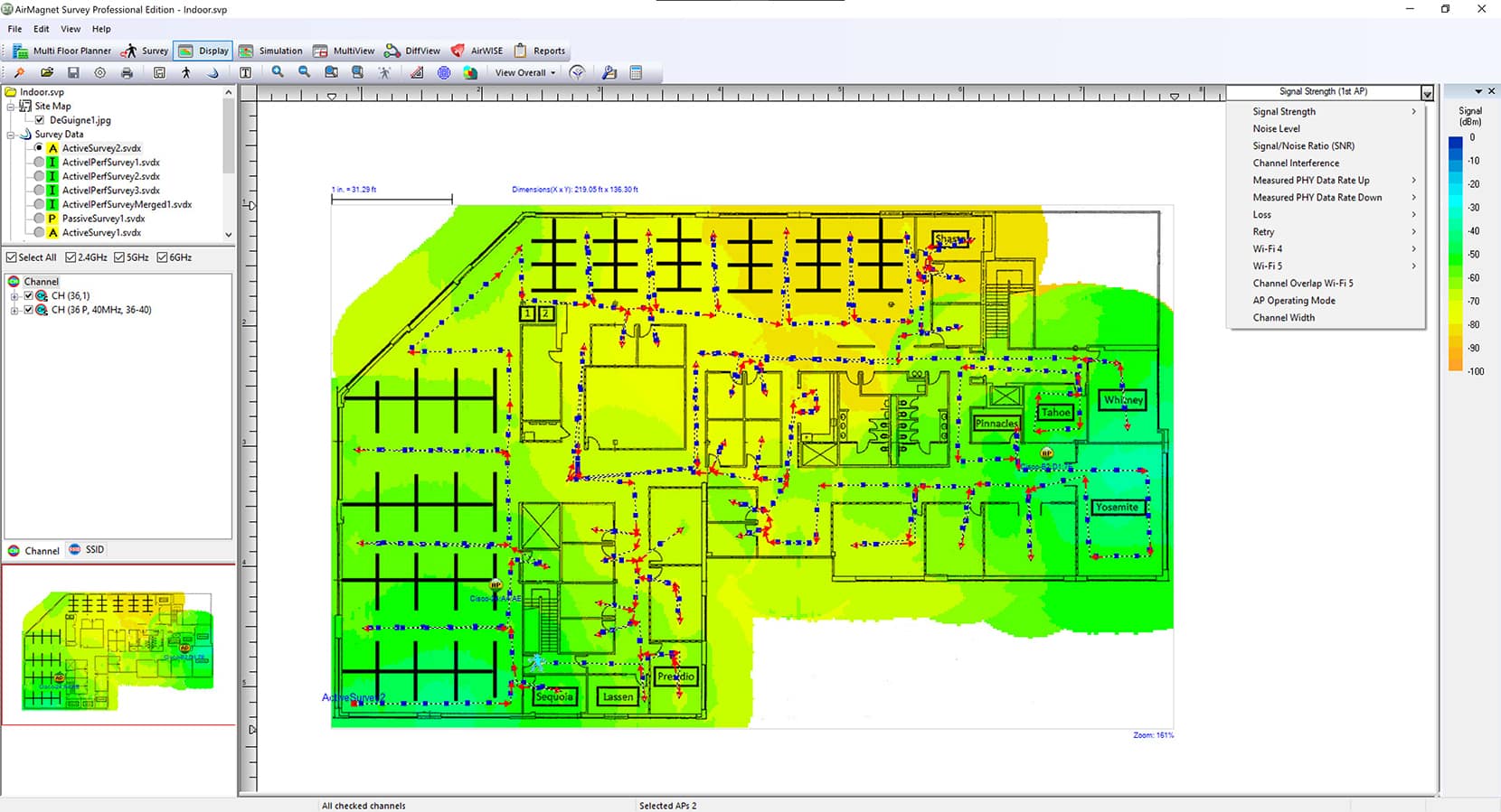
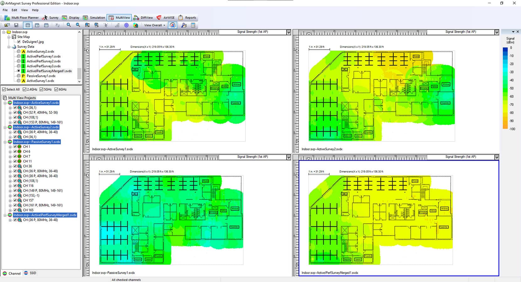
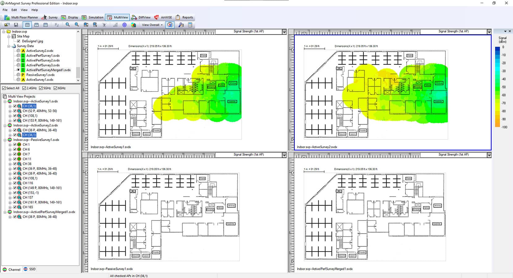
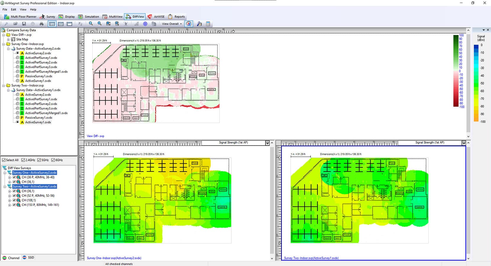
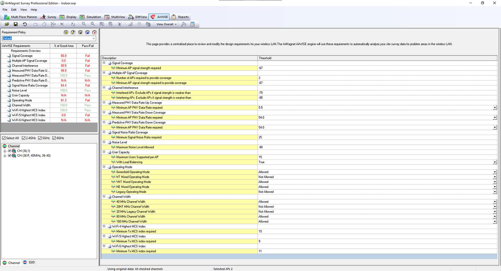
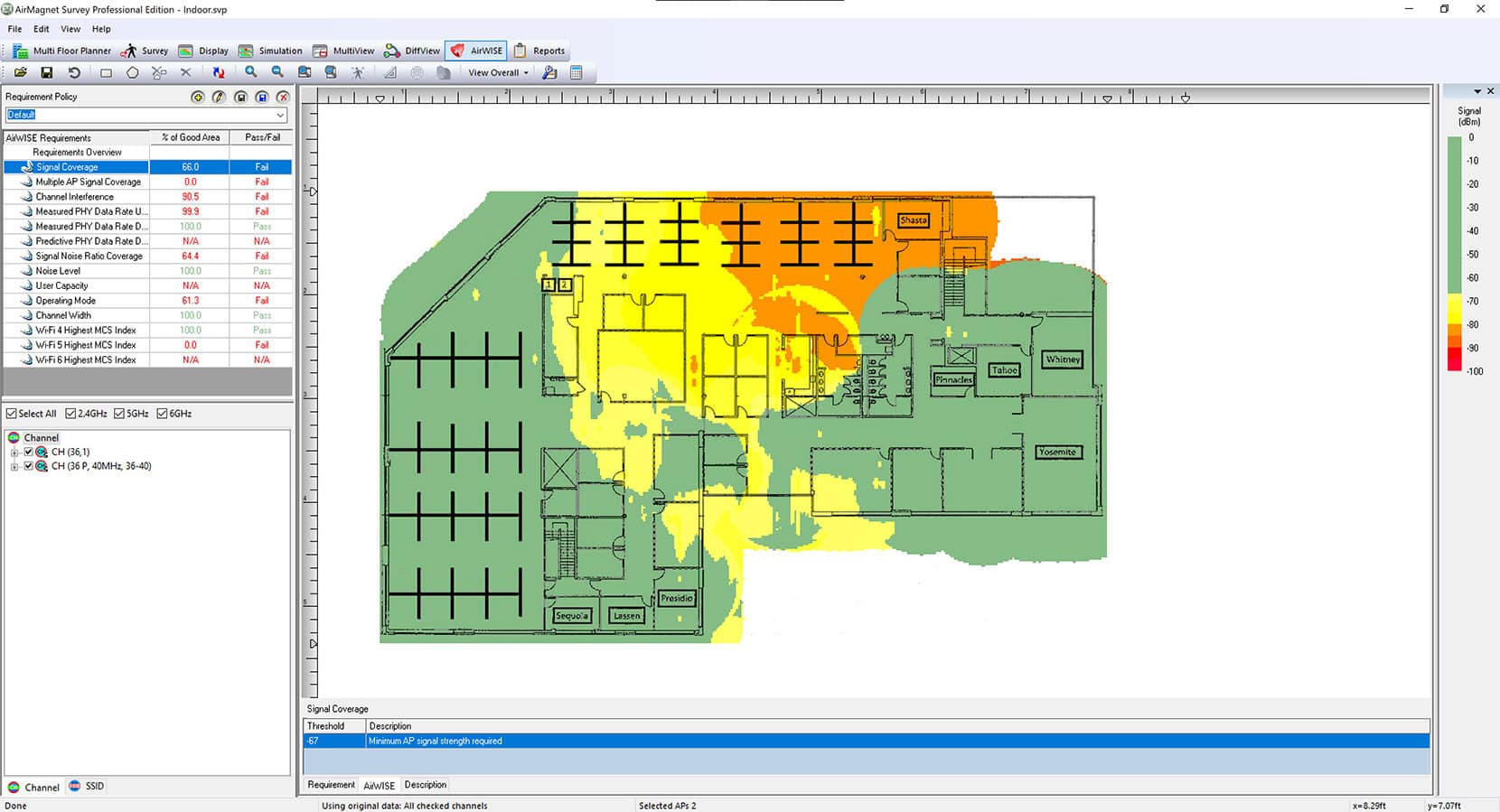
With AirMagnet Survey PRO, users can design new multi-floor Wi-Fi 7 networks, as well as plan their migration strategies for existing legacy networks, including one-to-one replacements or the phased introduction of devices into their legacy network. Users can plan their deployments for user capacity or performance without any physical AP rollout. AirMagnet Survey PRO provides unique coverage maps for WLAN throughput and other technology specific visualizations such as signal coverage, Operating Modes, MCS Transmit Rate, Channel Width, and Channel Overlap, to predict the WLAN performance at every location on the floor and offer the best design that minimizes any rework once the network is deployed.
Automatic Wall Extraction (AWE)
Users can reduce the amount of time spent preparing a floor plan for wireless deployment by quickly importing walls from CAD floorplans with only a few clicks of the mouse. Each CAD layer can be individually selected and given a unique attenuation type.
- Perform faster and simpler Wi-Fi site surveys on a fully mobile platform – no dongle or tethered device required
- Save time with simultaneous active and passive surveys in a single walkthrough
- Create visual heat maps of key performance metrics
Experience the power of GPS integration and Google Earth compatibility with AirMagnet Survey PRO:
- Automatically collect data using your NMEA-compliant GPS device for outdoor surveys
- Analyze results in our interface or export into Google Earth for detailed street view
Note: GPS survey support requires the use of the AirMagnet Survey PRO software and a Wi-Fi adapter for data collection
AirMagnet Survey PRO’s Wi-Fi heatmap software goes beyond basic RF coverage checks with comprehensive network analysis:
- Generate detailed heat maps showing WLAN coverage, noise, SNR, and interference
- Analyze throughput, data rates, retries, and packet loss
- Make informed design decisions using our NXT portable spectrum analyzer to visualize RF energy
- Identify and address performance issues including interference
Note: Spectrum analysis requires the use of the NXT-2000 portable spectrum analyzer on the AirCheck® G3, EtherScope® nXG, CyberScope® or CyberScope® Air. Noise and SNR measurements require the use of AirMapper Site Survey.